 |
Ken Baldry crosses Switzerland on Foot -Lenk to Gsteig direct |
 |
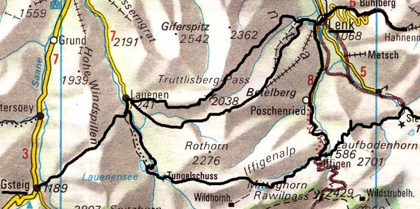 |
Route: Lenk-Trüttlisberg Pass or Stübleni Pass-Lauenen-
|
Tuesday 20th June 1978 Truttlisberg Pass from Lenk to Lauenen and Krinnen Pass from Lauenen to Gsteig
|
The bill at the Hotel Waldrand 40 fr again. (Don't expectt o get that toady!) The weather looked a lot better and by the time I had attacked my breakfast buffet, much of yesterday's snow had boiled off. This was a very big day. I went up the Truttlisberg Pass 2038m which had a nasty soft snowfield at the top. I put both feet through into a stream at one point and so ended up with blisters. (I was wearing new boots for the first time). Despite Hotel comment, it was quite practical and I got to the top in good time. Down the other side, it was very slippery and greasy. Alternative - The Stueblenipass.There is an alternative to the Trüttlisberg Pass which I did in 1979. The Stueblenipass is about one kilometre to the South, that is, up the same valley but going via Muelkerblatt. This is not muddy & much more fluoriferous. Most guidebooks don't mention it! |
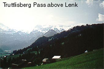
From the Truttlisberg Pass. The Stueblinipass goes up on the opposite tree-covered ridge. 1978 photo. |
The Krinnen Pass
In 1978, I met two Canadians doing the same thing in the opposite direction. I arrived down in Lauenen 1241m at 1330. It is a nice little village. Had I been intending to stay, it had a couple of inviting-looking hotels and in fact, Jane & I did stay in the Hotel Wildhorn in 1979. But I wasn't and set off for the rather lower Krinnen Pass 1659m over to Gsteig. Half-way up, I got lost in the woods owing to the path disappearing into the bog that most of this pass comprises. I just headed up towards the notch in the skyline whenever I could see it through the solid mass of trees and found the path again, away to my right about 20 feet below the hause.
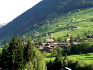
Lauenen |
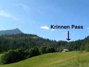
The Krinnen Pass from the Lauenen side |
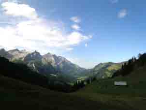
The great view West from the Krinnen |
In 2005, I had no trouble with the route up the Krinnen Pass & the locals have made some attempt to mitigate the squelchiness. This is the easiest pass on the whole Cross-Swiss Walk.
Another Alternative - Going to Lauenen via Iffigenalp
It is an easy walk from Adelboden to Lenk & it is only another two & a half hour's walk on to Iffigenalp from Lenk, taking in the splendid Iffig Falls on the way. I did this on Monday 5th September 2005.
From Iffigenalp, there is a more sporting alternative to Lauenen on this link.
Contact: Ken Baldry, 17 Gerrard Road, Islington, London N1 8AY +44(0)20 7359 6294 or e-mail him
URL: http://www.art-science.com/Ken/Alpine/XSwiss/alpine8.html Last revised 26/6/2008 © 1998-2008 Ken Baldry. All rights reserved.