 |
Ken Baldry crosses Switzerland on Foot -Ischgl (A) to the Heidelberger Hut (CH) & to Ardaz in the Engadine |
 |
Ischgl to the Heidelberger Hut & to Ardaz (Fuorcla da Tasna)
|
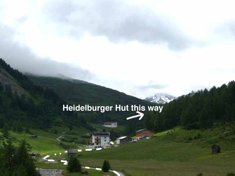
The 2011 trip started by rail from London-St Pancras - Paris - Zürich - Feldkirch (Austria), where I stayed in the nice Hotel Bären. Thursday 30th June 2011 Starting in Feldkirch, I took another train to Landeck & a bus to Ischgl. In Ischgl, it had looked as if the path by the gondelbahn was gesperrt, so I walked up by the church on the road. I passed a chapel where the closed path should join. It took 2 hours & 9,000 paces to get to the Bodenalpe, where I stopped for a beer. There is a little chapel there dated 1610. It took another 2.5 hours to the hut, making 5 hours altogether & 20,600 paces from Ischgl. This is all road or jeep track. The frontier is a joke, now, with an aged, obsolete, customs sign & wild horses. There was fitful Sun all afternoon. Over dinner, I mainly chatted to a young couple of mountain bikers from Stuttgart, she complaining of the effort from Ischgl (hardly) but they intend to go to Samnaun tomorrow, which will start with a push & have another later on. |
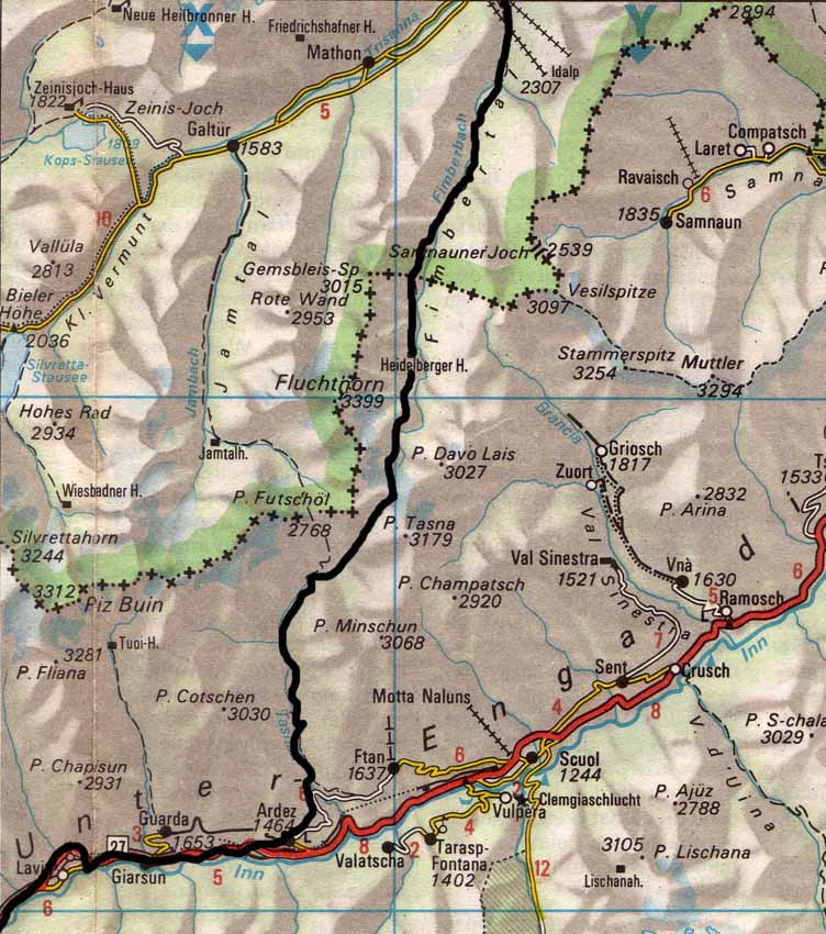
Map (not to scale) from the Official Map of the Automobil-Club der Schweiz, (with their permission) which is on this link. |
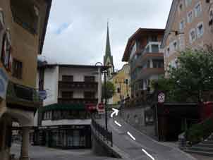
Where one starts in Ischgl |
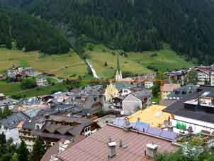
Ischgl from above |
Bodenalpe |
Friday 1st July 2011 Fuorcla da Tasna to Ardez
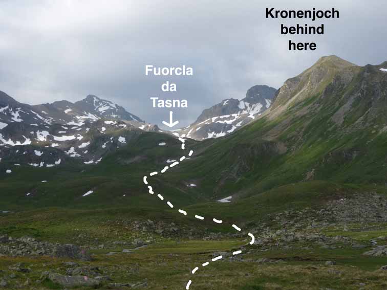
I had not slept well even though I had a room, because the restless guide in the next room turned his lights on & they leaked into mine. Today was the sort of experience that has one asking, "Are your solo back-packing days over?" Good buffet breakfast at 7 & out at 0750. The route is the same as for the Kronenjoch until a big cairn on the way up to the joch after the big wash but there is no signpost there. Before the split in the path, I put on my Blacks anorak, as it was now pretty cold & none of the promised Sun, although I had put sun cream on in anticipation. The split is marked by a large cairn, with blue waymarks going up to the Kronenjoch & red ones going off South towards the Fuorcla da Tasna. The waymarks are quite good on this side of the Fuorcla da Tasna, which I needed to cross to get to the Engadine. However, there were many large stones & snowfields to negotiate to get to the pass. So far, so ok after a quite tiring 2 hours, 50 minutes, which seemed about right.
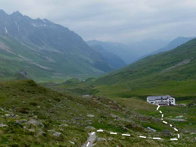 Up from the West side of the hut |
 Boggy area & a long way to go, yet |
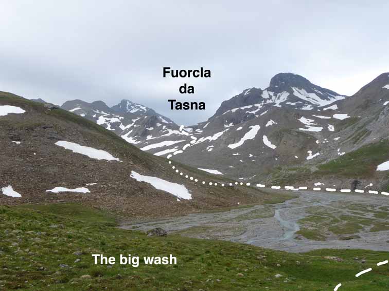 The big wash. View from the top of the dots on the previous frame. |
 Where the path splits. Left to the Kronenjoch. |
 By the small lake. Cross its exit stream. |
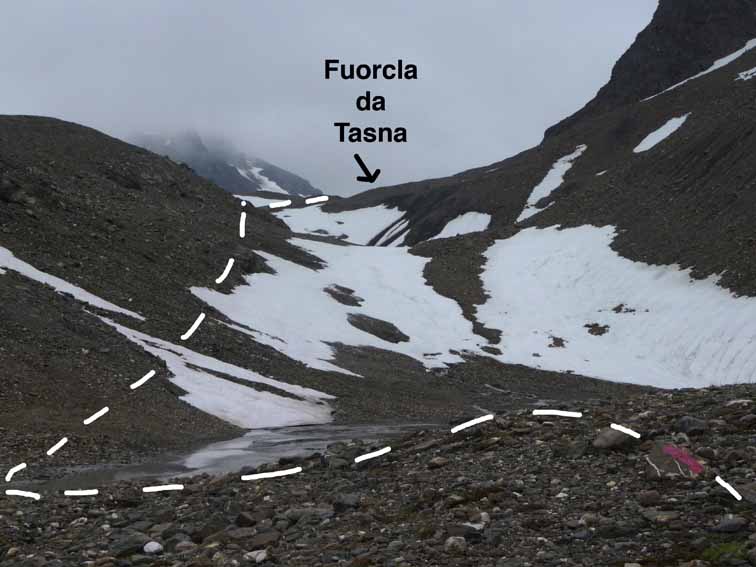
 2845 metres. The Top. |
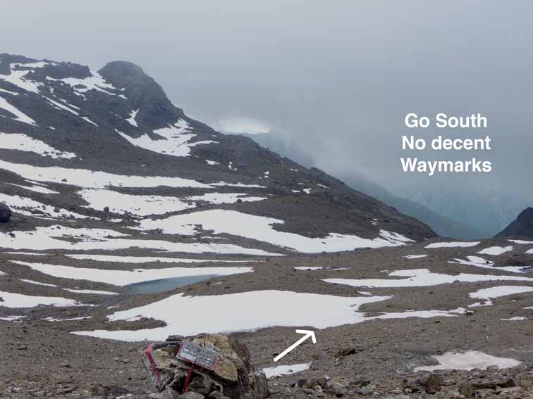
More tedious snow, then stone fields from the pass down to the lake, the Lei du Fasch Alba & now, rather erratic way-marking.
Looking back up from the South side of the top |
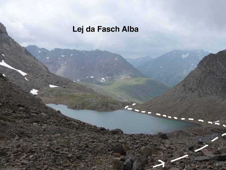
Lai da Fasch Alba |
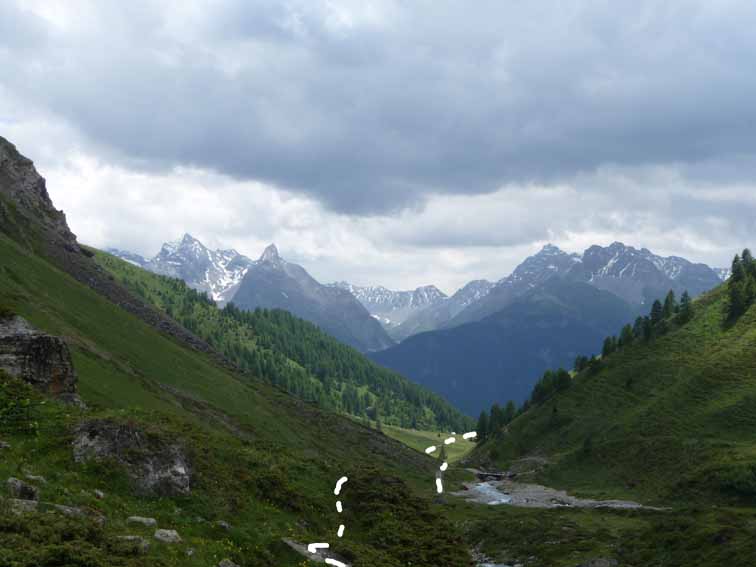
From Alp Vermala 1979m, |
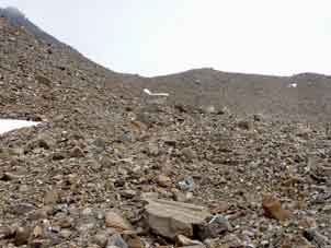
It was difficult to get down by the run-off from the lake, although the waymarks were now good. It was one of those delicate loose rock moraine paths & quite steep. But just before the 'route' reached the cataracts from the lake, there was a round waymark & no more. It was steeper, shaly & no obvious way past the mess next to the cataract. A snow storm started. It took me about half an hour to negotiate the next 100 metres & at one point, I slipped but saved myself at the expense of getting covered in shaly black mud, both trousers & anorak. I later learned another German word: hagel meaning hail & high-speed hailstones Hurt, especially when trying to work out how the hell am I going to get down to & across this waterfall. In the end, I got into a side gully which was not too steep & moved down the middle of it, getting my boots full of water. When I got over the waterfall, the waymarks mysteriously reappeared for about half a mile, starting with another round one, suggesting that this piece of the 'route' is never stable & you're on you're own in negotiating it. Then, they disappeared again. The dodgy waymarking suggests that this route is not fixed & probably depends on the depredations of the previous Winter every year. After crossing a wet field, I crossed the stream again & found more waymarks. Only eight more miles to walk down to the Inn valley. It must be clear that this is not a very recommendable route, especially for 68-year-olds.
At Ardaz, I tried the Hotel Muntanella. Full, but the girl rang the other hotel & thankfully, it had rooms. This was the Hotel Alvetern at the other end of the village & looked better modernised than the Muntanella. It may have been cheaper as well.
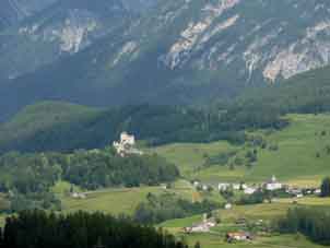
Caste Tarasp in the Engadine (Inn Valley) |
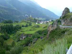
Ardaz |
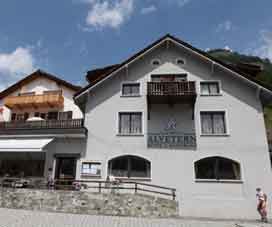
Hotel Alvetern in Ardaz |
Fortunately, Swiss landladies are very tolerant of the appearance of an over-worked sewer man. Both my trousers & anorak were bespattered (so heavy were my trousers with mud that they kept trying to fall down) & washing them filled the shower with mud, I jest not. Dinner was spätzli , mixed with ham & vegetables, then a Coupe Danemark. I rang Avis on the landlady's mobile & was not particularly frank about the day. The landlady was pretty mobile herself - one of those bird-like characters. I was out for 8.5 hours altogether but only 36,008 paces.
Contact: Ken Baldry, 17 Gerrard Road, Islington, London N1 8AY +44(0)20 7359 6294 or e-mail him
URL: http://www.art-science.com/Ken/Alpine/XSwiss/alpine22.html Last revised 14/9/2009 © 2009 Ken Baldry. All rights reserved.