 |
Ken Baldry crosses Switzerland on Foot -Iffigenalp to Gsteig |
 |
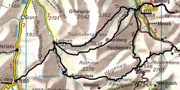 |
Route: Iffigenalp-above the
|
Tuesday 6th September 2005 Iffigenalp - Lauenen
Away at 0805 after a jolly goodbye from Frau Gfeller of the Hotel Iffigenalp, who charged me Sfr 160.80 for half-board & all the beers & coffees I had consumed in two days. Hut prices. She said I was going up the "Dungel Pass" route but that is not quite what this is, as it goes high above the pass. The Sun hid in the clouds at first, so it was comfortably cool until I was a little way below the Iffigensee on the usual Wildhorn Hut route, where I had to put on my 19thC design anorak & it stayed on for a couple of hours.
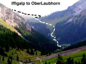
The OberLaubhorn is a brilliant viewpoint |
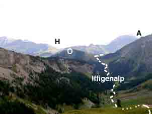
H=Hahnenmoos A=Ammerten Pass |
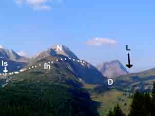
Is=Iffigsee Ih=Iffighore |
Above the valley to the North, the trees form a line along the cliff top, looking like sentinels & in fact, they are the custodians of our existence, turning the CO2 back into oxygen. Above the lake & after the hut path goes off, this path climbs easily to about 2300m & behind one, the view gradually develops, eventually going all the way to the, I think, Gspaltenhorn, the dramatic peak near Mürren. It was a blissful position & hard to tear away from. In the photo above right, the path skirts the Iffigsee (left) & goes up behind the Iffighore, then behind the ridge seen to the right of the Niesehorn. The high point shown is pt2300m. A little way down the West side, I met a 50ish woman with grey pigtails, who I asked to take photos of me, which she did.
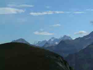
The view towards the Blumlisalp from near |
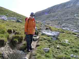
Me here. Big beard helps |
NW from near the top. Hohe Wispile |
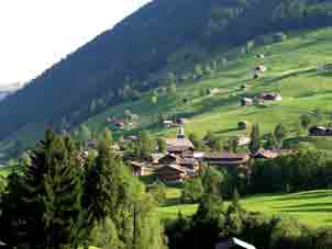
Then, the pass divides. One way goes steeply down to the Dungel Pass proper & the other carries on Westwards across the flank of the Niesehorn, which overhangs the Wildhorn Hut on the other side. The sign has an addition saying that the paths are only suitable for Berg geeubte, mountain adepts. This is a bit brutal if you do not think you are, as it is a long retreat. However, I ought to be an 'adept', so I carried on. Soon, I saw a French-speaking couple essay a short cut, relying on their Lekis & which I could hardly bear to watch but had to, in case I had to report an accident. However, they were lucky, rather than adept. There was an unpleasant piece of path but it was not sustained. The path is quite long & I stopped for a sultana lunch before reaching the Chue-Tungel, a cow meadows with barns. The sign up where the true Dungel Pass goes off had 'Vorsicht!' on the way I had come. However, there are worse paths with no warning in this country. I heard big cow bells at lunch & saw them being taken down for the Winter, not otherwise dressed up & nor were the peasants but were also herded by their intellectual superiors, the goats. I had the use the path they had shat all over. In the village, I decided to go down the steep zig-zags to the Lauenersee, assuming that they would not have taken the cows that way but, after I was committed, this turned out to be a big mistake, as the cows had turned the path, otherwise a good pack-horse track, into a complete schweinerei, as they shit when they panic & must have done a lot of it. This made it much harder for me - I would pick this one day of the year! However, I took the Eastward path round the lake, having the opportunity to wash my boots on the way & had a bit of luck, as a path was marked going, after a brief up, down to the Röhr or barrel, a valley which also leads straight to Lauenen but apparently, did not have a road. The path descends steeply but well through the trees, with a children's playground halfway & trees sculpted with a chain saw into animal forms, some clearly recent & some of several years. The bottom is the same altitude as Lauenen, so there is a long flat walk through the woods to a bit of badly made-up road which ended, as far as I was concerned, at the Hotel Alpenland just South of Lauenen.
The East German chap on the desk was very chatty & gave me a Sfr100 room for Sfr90. It had a real bath, so I soaked for an hour after doing my laundry. I had not gone all that well on the way down & assumed that Frau Gfeller's water was not that good. I had a slice of tart & coffee while I wrote this up. Then, I talked to an Irish couple who used to work in Geneva, as I had said that they were off the beaten track. Dinner off the menu was salad, wonderful spinach soup, giant vol-au-vents stuffed with veal & mushrooms & a huge Coup Belle Helene!
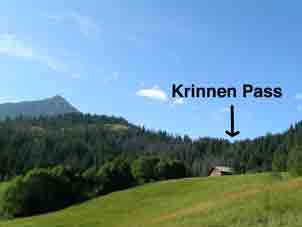
Wedesday 7th September 2005 Krinnen Pass from Lauenen to Gsteig via the Hoehe Wispile
A huge breakfast at 0745 with more boiled eggs. I rang Avis after it & got through at last. She had had telephone troubles but these had been sorted out. I left at 0855, Sfr138 lighter but that included everything. No trouble with the route up the Krinnen Pass this time & the locals have made some attempt to mitigate the squelchiness. There is, of course, a great view to the West from the top but I carried on up to the North on the path with excellent zig-zags to the Höhe Wispile. (You could just nip down to Gsteig but what are you going to do for the rest of the day?)
Lauenen |
From the Lauenen side |
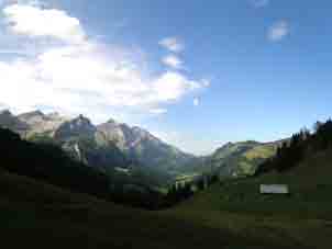
The great view West from the Krinnen |
This is a 'granny path' as people come down it from the gondelbahn &, at the top of the zig-zags, I met a party of four, one of whom was blind. The Höhe Wispile is a heavenly place, the path wandering up & down along the ridge with views on both sides & also backwards. Before getting to the ski café just past the summit, there were four Vicunas, rather a long way from home. I had a käseschnitte, served by a waitress from Swaziland. Wandering down, I met a nice German couple, Anna & Peter, who insisted on taking my photos for me. They spoke good English & had a chalet in Gstaad, inviting me. I asked them to e-mail me, as they received the fourth calling card of the day, having met several English people walking from the gondelbahn.
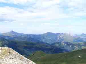
East from the Hoehe Wispile |
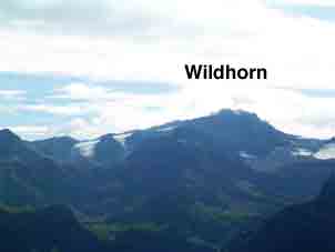
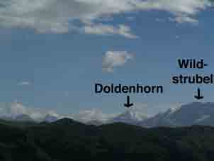
Wildhorn the Hoehe Wispile |
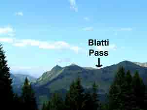
Blatti Pass (West) from the HW |
Just below the mittelstation, my luck ran out. A jeep road goes gently up for a km & was shown on the map as leading to a path towards Feutersoey. Warning! There is not & never was such a path & I retreated in fairly high dudgeon. I carried on down the winding road to Moosfang, waited for the bus which did not turn up & thumbed a lift to Gsteig. I had plenty of time to walk it but did that stretch ten years ago. Only the Hotel Baren was open & I was quoted an outrageous price by, I think, the landlady, as I would be one in a double room. This had no shower, which I had expected & not much room to do my laundry. (I was charged less than expected on the morrow, thank goodness). Going for a coffee, I chatted to a couple of weird American cousins, who did not seem to have much idea, although they spoke German. I directed them to my web site. Dinner was just a bratwürst & I had a talk to the landlord during it.
Contact: Ken Baldry, 17 Gerrard Road, Islington, London N1 8AY +44(0)20 7359 6294 or e-mail him
URL: http://www.art-science.com/Ken/Alpine/XSwiss/alpine8a.html Last revised 26/5/2012 © 2005-2012 Ken Baldry. All rights reserved.