 |
Ken Baldry crosses Switzerland on Foot -Wengen to Mürren |
 |
 |
Route:
|
|
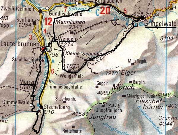
Sunday 17th July 1988 (Lauterbrunnen to) Wengen to Lauterbrunnen This was to be a lighter day and it was, compared to the vertical mile of yesterday. I walked to the Trümmelbach falls, going wrong twice. Then you can't go wrong, as the path is cut precariously into the sheer rock walls of the valley at first. After becoming more civilised, you drop into the Trümmeltal gorge and up the other side. This path is not the one marked on the 1968 LK. It meets up with that one above the gorge and I went round to the Stafelalp. It picks up the blue ski run at the bottom of the Bumps lift and so to Wengen 1274m. I talked to some Americans as we looked at cows with their posh bells on and went with them down into Wengen. |
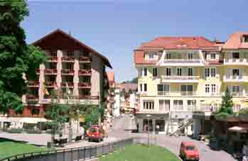
Downtown Wengen |
|
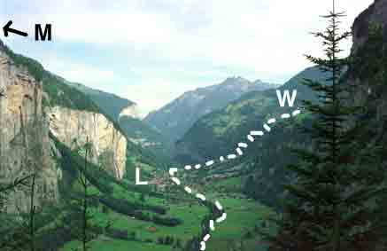
They went on and I had a snack in the Crystal Café (now defunct - try the Café Gruebi instead), from where I watched the Wengen Carnival (DorfSonntag - Village Sunday) procession go by. It was not as good as the Zermatt one but an unexpected pleasure all the same. It only takes about 40 minutes to go down to Lauterbrunnen at 786m on an easy footpath through the woods. I picked up my rucksack from the hotel and caught the 1508 train to Interlaken and on to Zürich as this was part of a bona-fide business trip that year, honest! Photo right: M=Mürren further up the hill, W = Wengen, |
 |
Friday 15th July 1988 Lauterbrunnen to Stechelberg
Coming from a business meeting in Geneva, I got off the train in Bern and bought a return to Lauterbrunnen 786m and one to Grindelwald, to confuse the conductors later. Then I went to Lauterbrunnen, chatting as far as Interlaken to an old English couple. The conveniently placed Bahnhof Hotel had a room for me (sf60).
As a warm-up, I walked up the valley by the side of the stream to Stechelberg 910m and was most impressed. It broadens out halfway but there are waterfalls all the way along. You could walk along the road. I got a lift half-way back from some religious types and chatted to two American women in the bar of the Bahnhof.
Saturday 16th July Stechelberg to Mürren
|
Cloud was floating about. I bought some supplies in the Co-op and caught the bus (South Effricans and a Korean) to Stechelberg 910m to walk up to Ober Steinberg 1774m. The first part to Trachsellauenen was more uppish than I had thought. The Breithorn and the Grosshorn occasionally came out of the clouds. Going up the Ammerten Cliff path was bit like the Undercliff at Lyme Regis but a lot longer. It was still cloudy when I got to Ober Steinberg, so I had a beer and turned north up the path across the Tschingelgrat to the point where it crossed over into the Sefinental. The hills came out occasionally, making it all worth while. A track was marked up to the 'Tanzbödli' (dance floor) and I took it. Steep and nasty, it came out on a flat bit of ridge below the first crag (c2100m). I had a good view of the Jungfrau. The path down was nasty mud at first, then steep gravel down for ever to the brook at 1250m. | 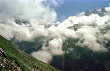
Grosshorn from Ober Steinberg |
Then I went up to Gimmelwald and Mürren 1645m, where I had dinner (cordon bleu and salad) at 1600. I still had an hour and a half of walking down to Lauterbrunnen after that.
This link for pictures of Mürren in the winter (ski season).
Of course, you can just walk up from Lauterbrunnen to Mürren on the marked path
through the woods but my route would take all day & be more fun.
Contact: Ken Baldry, 17 Gerrard Road, Islington, London N1 8AY +44(0)20 7359 6294 or e-mail him
URL: http://www.art-science.com/Ken/Alpine/XSwiss/alpine6a.html © 1998-2012 Ken Baldry. All rights reserved. Last revised 27/5/2012