 |
Ken Baldry crosses Switzerland on Foot -Grindelwald to Wengen (2 ways) |
 |
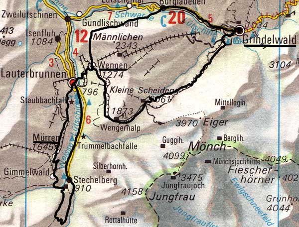 |
There are two obvious ways to do the next stage. I did the first in 1974. In 1974, Jane and I went off on holiday at the end of August. This was one of those amazing occasions where one sets out with an ambitious plan and completes it. Because of Eric's mishap, (my uncle, who died in an air crash) Jane, who had never liked flying, suggested that we take couchettes to Grindelwald 1038m, so we did. On trains, you can talk to people and it does feel more like travelling than flying. We walked up to Grosse Scheidegg 1961m & back in the evening.We did a training walk up to the Gleckstein Hut on the Wetterhorn then set out on our great adventure, the final objective of which was Fafleralp in the Lötschental. This map is copied from the Official Map of the Automobil-Club der Schweiz, (with their permission) which is on this link but not to scale. |
Route Two: Grindelwald to Wengen 1972, 1988 & 2001In September 1972, we walked up to Kleine Scheidegg from Grindelwald. You have to go down to Grindelwald-Grund first, either by the road (1972) 100m East of the railway station or the path 300m past the railway bridge over the main road (2001). The path goes steeply up South of the Grund Station & rejoins the road up to Brandegg Station, where the slope eases. The path then either follows the railway until a couple of kms before the clearly seen Kleine Scheidegg (1972) or branches off into the woods from Brandegg (1988 - I was writing a novel, the hero of which is murdered in these woods & was researching the location). It can be cooler in the woods but takes longer, 5 or 6 hours up altogether. |
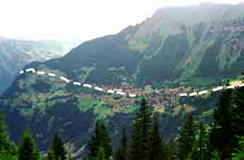
Wengen from the Kleine Scheidegg path |
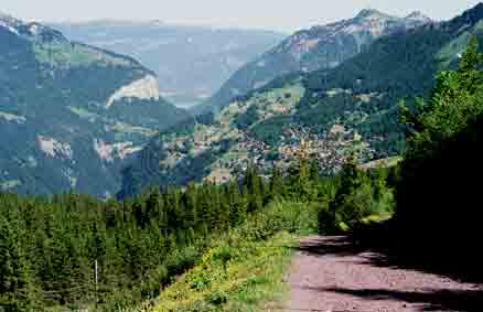
Tuesday 26th June 2001 However, the path down to Wengen only takes 1 1/2 hours non-stop. But it is very tempting to linger under the Jungfrau (who's summit cannot quite be seen from here) & with grand views over to the Blumlisalp & Lauterbrunnen Breithorn, so I took 2 1/2 hours. There were also many alpine flowers to be seen by the path.
This link for pictures of Wengen in the winter (ski season).
Contact: Ken Baldry, 17 Gerrard Road, Islington, London N1 8AY +44(0)20 7359 6294 or e-mail him
URL: http://www.art-science.com/Ken/Alpine/XSwiss/alpine6a.html © 1998-2012 Ken Baldry. All rights reserved. Last revised 27/5/2012