 |
Ken Baldry crosses Switzerland on Foot -Netstal to Burglen - Pragel Pass & Suvorovweg |
 |
Route: Netstal-Klontal-Pragel Pass-Muotatal-Chinzig Pass-Burglen
The purposes of this variation are: it avoids the long Klausen road pass (actually only half of it is road on foot); it allows the full Suvorovweg to be walked and you get to visit the very pretty Klontaler See on the Pragel Pass, although a lot of the Pragel is road.
The Suvorovweg is over the Chinzig Pass & there is another option for using that pass on this link. In 1799, the Russian General Suvorov out-flanked the French by taking his army over this pass. It is unbelievable how he managed to lug cannon etc over the narrow tracks at the ends of the pass.
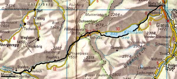
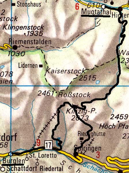
This map & the one below are copied from the Official Map of the Automobil-Club der Schweiz, (with their permission) which is on this link but not to scale. |
Wednesday 6th September 2006
|
Overlooking Netstal |
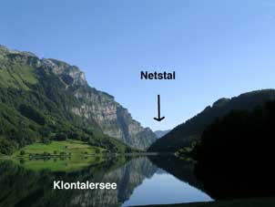
Looking East back along the Klontalersee |
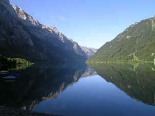
Klontalersee looking West |
The Klontalersee is one very pretty lake & it is a long, flattish walk along the South side, being the road to a camp site, then jeep track, then path. This is blessedly, all in the shade. At the end, it is clear where to cross the stream but the path to the left I had intended to take was invisible & I slogged steeply up the side of a little stream to the main Pragel Pass road. (There is a sign-post to another track pointing to the right after the bridge). The road has to used up to Richisau. Then, the old packhorse track takes one right off the road at the end of the Richisau meadow but the bit at the end is invisible despite the signpost on the road where it crosses the old track. I had to disturb cows to get across to where I could see my way, so the advice here is to take the road & avoid wasteing 50 metres of height gain. When the road does a zig-zag, the old track goes straight on up to the pass & over it towards the chapel, which is where the restaurant is. It took me (age 63) 30,000 paces & six hours to get up. Someone told me this was fast. Lunch was Sfr 16.85.
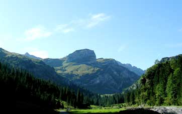
The crag above the Pragel from Richisau |
Looking SW from the Pragel Pass |
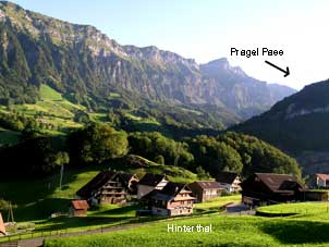
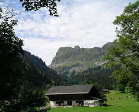
Hinterthal (Muotatal) |
There was a lot of pack horse path on the way down but over half of the descent is on the road after it is joined & a bit wearing. In Hinterthal, only the last hotel towards Muotatal was open, the Hotel Tell & they had a discussion about whether to let me have the room but they did & a better one than yesterday. There were two old boys who had been rock-climbing up East of the Bisistal. They were 66 & 75! I rang my wife, using someone's mobile, telephone boxes in hotels seemingly having died out.
Thursday 7th September 2006 The Suvorov Weg to the Chinzig Pass LK246
|
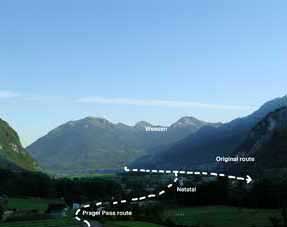
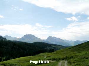
Good breakfast!I came down in my boots, as I had paid last night & breakfast was at 8, so I was out at 0819. I walked back to the bridge East of the village & picked up the Suvorovweg, which for a short way is metalled. But then, there is 800 feet of narrow, winding path through the woods beside the stream. This is one of the places where it is hard to image him getting an army up in 1799. After that, though, the gradient eases & there is good pack horse track through the Liplisbuel cow village which again, stayed in the shade for a long time. There was a short bit difficult to find, where the jeep track goes off to the right of the valley when walkers want to stay on the left but eventually, one comes out at the cow village of Chinzig. After talking to a chap who had come over, I found the path a bit confusing again, so struck straight up the hillside until I found the track I had used six years ago, which took me to the little chapel on top of the pass. This took 5.5 hours with rests & it was a lovely day, like yesterday. The views are spectacular. At the top of the Chinzig Pass... ...it is decision time. Either one can go down the rest of the Suvorov Weg towards Burglen, which I did in 2000, and pick up the original Cross-Swiss Walk route on this link or take the path leftwards down to Spiringen, which I did in 2006. This was a mistake. I took the left-hand & rather nasty path (steepish & slippery gravel) down from just below the top, instead of continuing on the Suvorovweg. This gets confused by the extension of metalled roads up to rather too high but at least, there was a clear route down to Ratzi, where I stopped for a beer & compared their map with my 1985 one. Then, on to Spiringen. However, both hotels in Spiringen had rest days today on the same day, note, so I walked all the way down, at least it was down, to Burglen. A half-day trip to Brüsti follows. |
Above Liplisbuel. The Matten Stock in the |
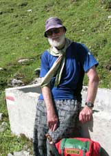
Your guide (me) above |
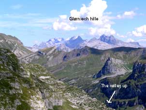
View North to the Glarnish |
Contact: Ken Baldry, 17 Gerrard Road, Islington, London N1 8AY +44(0)20 7359 6294 or e-mail him
URL: http://www.art-science.com/Ken/Alpine/XSwiss/alpine3b.html Last revised 26/6/2008 © 2008 Ken Baldry. All rights reserved.