 |
Ken Baldry's Alpine PagesWalks around Grächen 1611m |
Grächen |
is on a shelf above the Mattertal. |
How to get there |
Go to Brig (as described on the index page). Take the BVZ (Zermatt) train to St. Niklaus & either take the |
When you get there... |
...you need somewhere to stay. I either stay in the Hotel Zum See (beautiful setting), which is a |
|
The walk to the Hannig Alp & ridge above Further up the ridge - the Plattehorn Also, see the 'Round Monte Rosa Tour' for the stiff walk to Saas-Fee |
I have done all these walks myself. For wintry types, there is some skiing, but I have not done any here. |
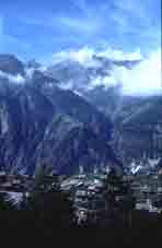
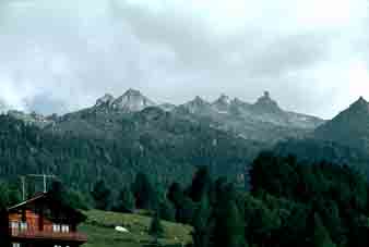
Grächen from |
Grächen from the Heidnische Tossen, on the walk down from the Wannihorn. 1970. |
First afternoon walk - to the Hannig Alp
|
This is the Grächen Hannigalp. There are lots of Hannigalps! A gentle walk from the village up past the Hotel Zum See & throught the woods for most of the way. There is skiing here in the winter and magnificent views north to the Berner Oberland. South. the ridge continues to the Balfrin but non-rock climbers will get little further! The beautiful Brunegghorn dominates to the West. For an extended walk, go up the path in front of the cafe to the ridge above the meadow & head South over the Kleine Furgge & Grosse Furgge to the Wannihorn 2669m (or Wannenhorn on some maps). There is a different path back down to the village from there through the Heidnisch Tossen. Alternatively, from the Hannig Alp, drop down the ridge to the café Hohtschuggen, hidden (but signposted) in the woods for tea & return to Grächen village by a more-or-less contour path. |
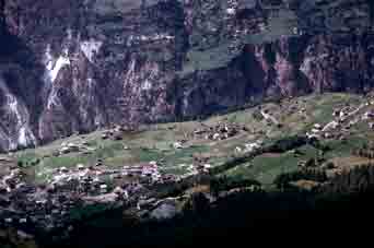
 Grächen from Jungu across the valley |
|
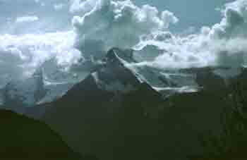
The Brunegghorn 3838m from the ridge. |
The Berner Oberland from just below |
The Balfrin (see this link to climb) |
Easy times - the Water tracks
Heading off southward in the woods from the Zum See & above, are irrigation channels (this is the driest Swiss village) dug along the contours, with paths on their downhill side. It is delightful & easy to walk along these, enjoy the views to the West & North and observe the wild life. There are still red (almost black) squirrels here.
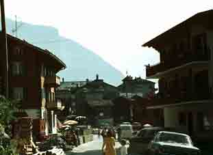
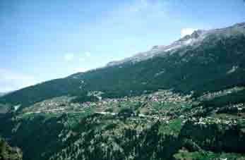
In the village 1973. |
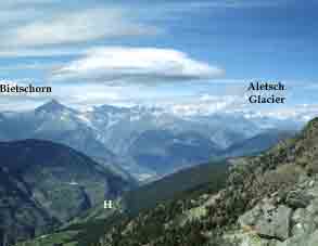
An evening view of the Bietschhorn in the Berner Oberland from the water track. |
|
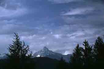
View from the village of the Wannihorn (left) & |
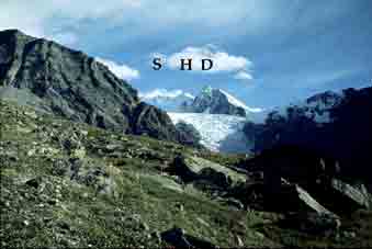
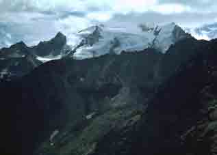
The Ried Glacier from Heidnisch Tossen. |
The Gabelhorn from the |
Other trips from Grächen
The Balfrin Hoheweg to Saas Fee is an attractive but quite tough back-packing way out of Grächen (or into Grächen from Saas Fee or Grund. I have done it both ways). This is a stage on the Monte Rose Rundtour. See this link.
You could reverse my Best Day in the Mountains trip to the Mischabel Hut above Saas-Fee by going up the Ried Glacier &
staying in the Bordier Hut, before continuing to the Mischabel Hut & Saas-Fee or combine these two trips. See this link.
There is a high-level footpath to Zermatt called the Europaweg, part of the Chamonix-Zermatt walk & a long & hard 2 days, on this link. Not for the faint-hearted!
Contact: Ken Baldry, 17 Gerrard Road, Islington, London N1 8AY +44(0)20 7359 6294 or e-mail him URL: http://www.art-science.com/Ken/Alpine/Graechen/index.html
Last revised 22/11/2010 © 1998-2010 Ken Baldry. All rights reserved.