 |
Ken Baldry's Alpine pages -The Sanetsch Pass |
The Sanetsch Pass
Route: Gsteig - Sion
Maps LK236, 'Wildstrubel' & LK273, 'Montana'.
There are only three walkers' passes across the main Berner Oberland chain, the Gemmi, the Rawil and the Sanetsch.
Wedesday 21st June 1978 & Thursday 8th September 2005
|
In 1978, I had come across the Krinnen Pass (on the Cross-Swiss Walk) & booked into the Hotel Victoria in Gsteig. When I filled in my registration form, the landlady said my destination, Sion, was impossible as the Sanetsch Pass was not yet open. Later, chatting to the much friendlier Wirt (landlord), I told him where I had come from zu fuss (on foot), so he told me much about the Sanetsch crossing, including the good advice to follow the pylons if the road had disappeared after the dam. The road comes up from the Rhone Valley as far as the dam but was invisible this year, of course, because still covered in snow. He was right. I saw some skiers when I was near the top of the pass & waved. |
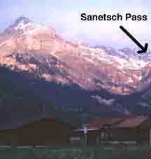
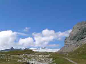
The pass from Gsteig |
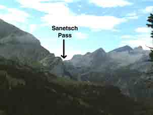
The pass from the Hoehe Wispile 2005 |
Later, they called me across to a little stone hut & filled me up with Fendant, the heavy white wine of the area. So, I felt no pain on the way down! Some way further down, you cross the Devil's Bridge, one of those amazing pack horse bridges which is above an apparently bottomless gorge. How did they build it? The track & road continue to Chandolin above the Rhone Valley. I stayed in Chandolin, as the day had been long enough.
On Thursday September 8th 2005, after an expedition to improve the Cross-Swiss Walk & add more photos, I planned to go up the pass again in Summer conditions & complete the walk to Sion from Chandolin:-
I left at 0826 for the Pass. After the initial zig-zags, there is a sort of little meadow & a straight path up to where the Walliser Wispile path joins from the left at 1481m. Over a bridge, there is the first of two cwms, with zig-zags up them until the path crosses an overhanging wall & finally zig-zags swing East up to the dam after about three hours.
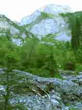
The first cwm |
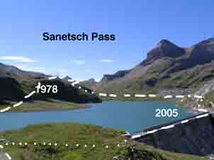
Showing the two routes at the top |
The glacier from the Diablerets |
Crossing the dam, I used the road from where I could marvel at the route I had used 27 years ago in the snow. Where they meet, there is a path up to the top & a great view South towards the Pennines & West to the glacier coming down from the Diablerets complex.
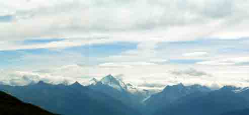
Panorama of the Pennine Alps, Dent Blanche centre, |
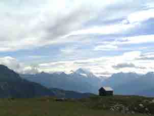
The hut (then in the snow in 1978) |
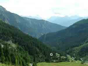
Glarey (G) & the winding gorge |
On the way down, there is a variation above the village of Glarey, probably because of destroyed track, although most of it seems to be good pack-horse. I went on to the Auberge Tsanfleuron, where, not having eaten for six hours, I had dinner, a tough cordon bleu with salad & chips. After another ten minutes walking, bang on my schedule, I thumbed a Dutch car down & took a lift to Chandolin, which is as far as I had walked before. Apart from the Devil's Bridge, this stretch is not that fantastic & I had hoped to get a lift here. |
Looking back up the pass through the |
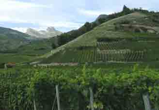
Then, I walked down the roads (there are no footpaths) through the vineyards to the Rhone Valley but the route comes out at Pont du Morges, which is another half hour or more to Sion Gare, so I was well knackered by time I got to the Hotel Elite, with its ebulliant landlady Laurette Melly
Contact: Ken Baldry, 17 Gerrard Road, Islington, London N1 8AY +44(0)20 7359 6294 or e-mail him
URL: http://www.art-science.com/Ken/Alpine/Sanetsch/index.html Last revised12/9/2005 © 2005 Ken Baldry. All rights reserved.