 |
Ken Baldry's Alpine PagesChamonix-Zermatt Walk - Forcletta Pass variation from Zinal to Grüben |
The Forcletta (French) or Fugglitti (German) Pass
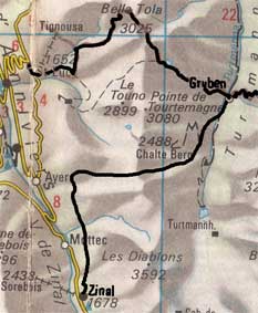 |
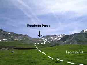
If you take the road at the side of the Trift Hotel, there is a track just before the laundry (blanchissement) to the left. Follow this, across the road & it gradually winds up through the trees. Be careful to take a left turn after 400metres of 'up', which takes you to a contour path, with splendid views back as more & more 4000metre peaks show up. It eventually turns right into a side gorge & a new sign up to the Forcletta Pass (not as on LK50 or the Kummerly & Frey map). The track goes up across meadows until the zig-zags start, which lead to the top of the pass. On the map at the left, this is the lower track. The upper one is over Bella Tola. This map is copied from the Official Map of the Automobil-Club der Schweiz, (with their permission) which is on this link but not to scale. |
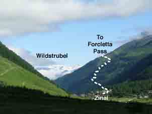 The Forcletta path up from Zinal |
 Zinal off to the right. |
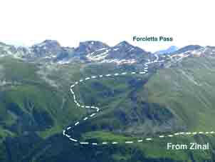
 The view improves magnificently. |
 From after the turn into the gorge. |
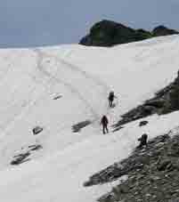 The top, East side with the clowns behind me. |
Much to my amusement on June 30th 2007, a party which whizzed past grandpa (me at 64) had to wait at the top until I arrived with my ice-axe to make a trail by cutting steps on the snow slope down the other side. Always take an ice axe on these walks. The path keeps to the left side going down before cutting across left towards a farm. This part goes up & down a bit. Below the farm is a jeep track, which is a snare, as the path later drops below it before making zig-zags to the Turtmanntal valley floor, where one walks down North to Grüben & the Hotel Schwarzhorn. There is about 1300 metres of 'up' but only 1100 down on this walk. |
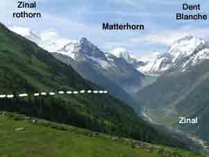
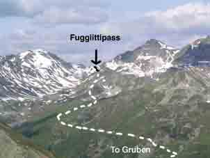 Seen from the East (Augstbordpass) |
Contact: Ken Baldry, 17 Gerrard Road, Islington, London N1 8AY +44(0)20 7359 6294 or e-mail him URL: http://www.art-science.com/Ken/Alpine/Zinal/zl2.html Last revised 14/11/2010 © 2007-2010 Ken Baldry. All rights reserved.