 |
Ken Baldry's Alpine PagesMonte Rosa Rundtour - 6 |
Stage Nine - From Breuil to Zermatt
Breuil High Street looks more normally alpine and is dominated by the South Face of the Matterhorn, which was plastered with snow in 1975. This is most unusual. These pictures of Breuil were taken in 2015, when I stayed at the Hotel Europa on this link.
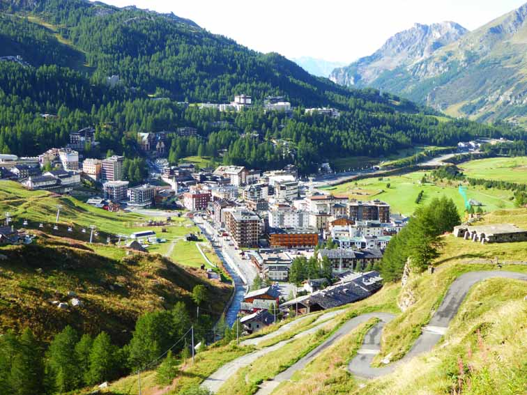
Breuil from the Matterhorn Hut path |
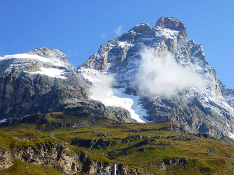
Matterhorn from the new flats |
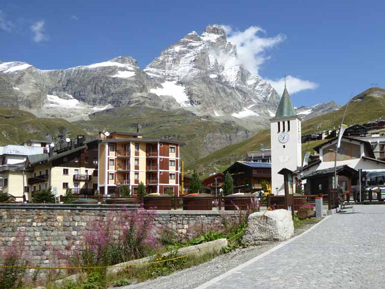
Breuil, Matterhorn & Church |
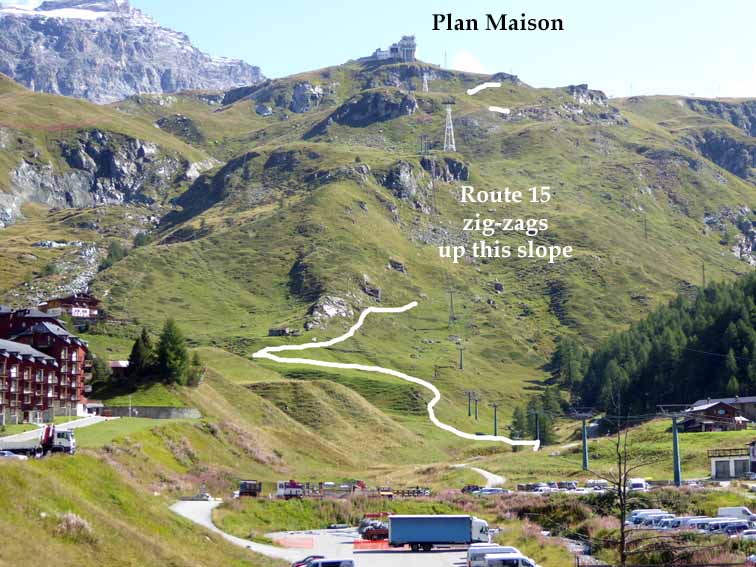
There are two starts to the walk up to the Theodule Hut, either via Plan Tourette from the North end of the village or the marked path 15 from the South end, marked at the left of the cable car station. This takes you up to Plan Maison, where the first cable car goes (In practse, I went up the former & down the latter).
1. Plan Tourette - There is a bridge over the stream by the car park. Cross it & take the jeep track going up to the left. The advantage (great for an old codger like me) is that there are no steep rocky paths on this route. Turn right past the Hotel Baita Cretaz, then left up a steepish grassy gangway by the drag lift. At the top, pick up the jeep track left & follow it round to Plan Tourette. This is all shown on the photo below left. At Plan Tourette, the bottom of the Pancheron chair lift, you can either follow the track up to Plan Maison & pick up Route 15. What I did was go up a derelict jeep track to the one to service the lift, cut across the hillside East when the track turned left & picked up Route 15 further on.
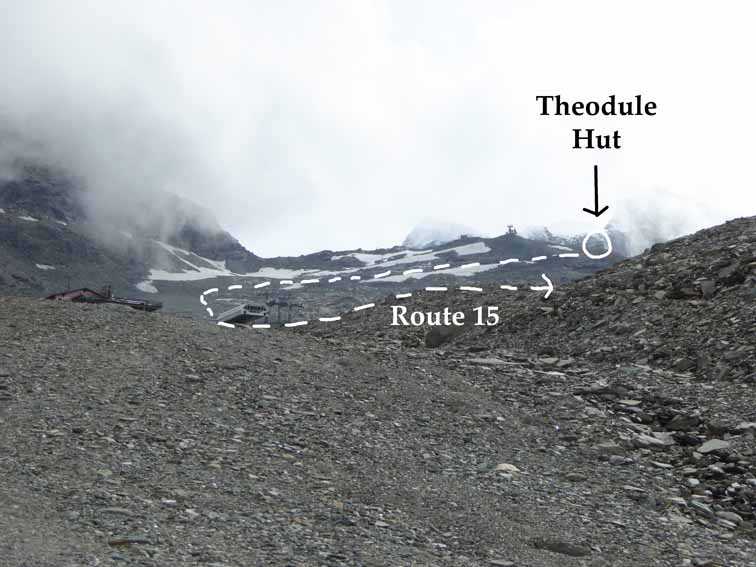
2. Plan Maison - There are Route 15 signs from South of the church, which lead to a couple of bridges to cross, one stone & one wood, where the rocky path up to Plan Maison starts. Then, the jeep track stretches off to the East & is followed to the hut.
Curiously, although the hut is at 3317m, since even a steepish jeep track is a stroll for a walker, this is a remarkably easy walk. The Plan Tourette variation has no zig-zags & was less than 16,000 paces for me.
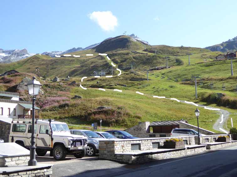
Plan Tourette start from the Town Car Park |
Route 15 start from near the Cable Car |
Bontadini Hut & frontier ridge |
In 1975, we took the string railway to Testa Grigia, 3479m, where we found that the Theodule Glacier was solid. It had been cut up by huge crevasses last time we were there (1971) & I was told it was impassible in 1999. But it is always marked with a safe foot route, although always check with the Breuil Tourist Office, now on the Ring Road & you might need crampons.
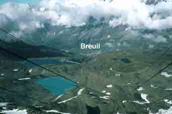
Breuil from Testa Grigia |
Testa Grigia from the Theodule Glacier |
If walking up from Breuil (about 4-5 hours - I took 4hr 40mins age 72), after lunch in the hut, there is plenty of time to walk down the Theodule Glacier to the Gandegg Hut on this link, where you could stay the night (check they are open). From the hut to Furi above Zermatt, there is no accommodation, which is a bit far for one day but you can always cheat & use the cable car from Trockener Steg to Zermatt, 20 mins below the Gandegg Hut.
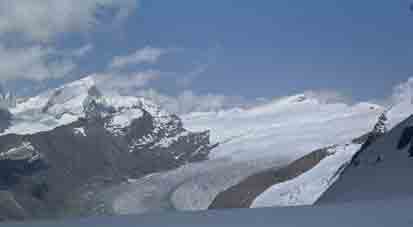
The Gorner Glacier from the Theodule Glacier |
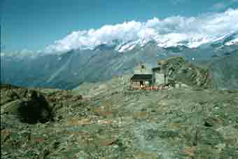
Gandegg Hut |
In 1975, we stopped off at the Gandegg Hut at 3029m for lunch and I later painted it with Jane in the forground. By the time we had got to Furgg, 2272m, slowly admiring those flowers that were still out, we had had enough and took the string railway down to Zermatt, 1616m. We have skied this stretch often enough! I did walk it in 1999, though, walking up an easy path to the Schwarzsee (2552m) on the Matterhorn from Furgg & walking down to Furi, which is much more pleasant than walking from Furgg to Furi.
Contact: Ken Baldry, 17 Gerrard Road, Islington, London N1 8AY +44(0)20 7359 6294 or e-mail him
URL: http://www.art-science.com/Ken/Alpine/Monte_Rosa/mr5.html Last revised 9/9/2015 ©1998-2012 Ken Baldry. All rights reserved.