 |
Ken Baldry crosses Switzerland on Foot -Galtur to St. Gallenkirch |
 |
|
Previous North East page: |
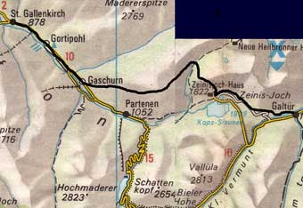
Galtur to St. Gallenkirch via the Zeinisjoch, Verbellaalpe & the Schrofen
|
This map is copied from the Official Map of the Automobil-Club der Schweiz, Saturday 5th September 2009 Not a cloud in the sky when I woke up but, & it's a big one, the snow line from yesterday & presumably, last night, was impressively low: about 1800m & a plan B was necessary. Good buffet & refused a fried egg but the total bill was €45.10. Incredibly low. Although it is partly jeep track, I went up the delightful way to the Zeinisjoch, only 1000' above Galtur & some way before the hotel & Kops Stausee. It is the border between the Tyrol & Vorarlberg & also the marked watershed between the Rhine & Danube. |
 |
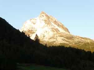
Galtur's Ballunspitze in the first Sun |
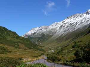
Galtur and Grieskogel with early snow |
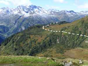
Easy track to the Zeinisjoch |
A stream comes down & splits each way. From the hotel, a path goes up to the Verbellaalpe past the Zeinissee & I soon fell in with a group of East Germans from Chemnitz & Dresden, two of whom were also 66. I talked a lot to a woman of 58 who works for a bank & knows a lot about computers. She plays the piano & took my last card.
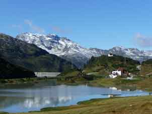
Zeinisjoch Hotel & Kops Dam |
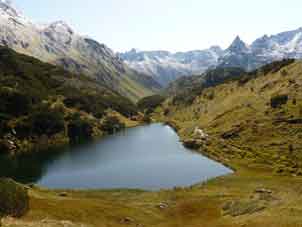
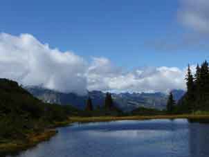
Zeinissee |
Verbellaalpe |
There were pigs at the Verbellaalpe. This is well up a side valley & I went on the other, Montafon, side, which brings you back towards the Silvretta while the Krauts went up to the Heilbronner Hutte. My path works slowly up after a drop & is largely, very well maintained, though some is corduroy, which keeps your feet dry in the bog but is not comfortable walking. With its little tarns, this, the Schrofen, is all a bit like Claife Heights. Some tarns had filled in & were grass covered.
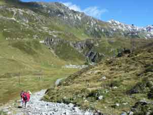
From the Verbellaalpe to Gaschurn |
Tarns on the Schrofen |
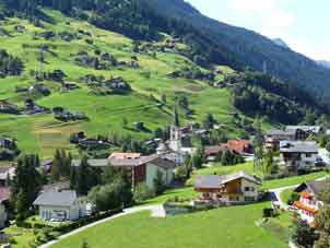
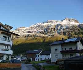
Gaschurn |
There were a lot of people, not surprising for a Saturday & when the other end is fed by a cable car, as it turned out at Tafamunt. One had been taken off the cable & the other only went to this mid point station. There was a café & I treated myself to a Wiener Schnitzel & beer (€13) at 1400. The path on was clear of others & after a sort of dropping contour path, went down steeply (tree roots) to Gaschurn, so was not very pleasant. I walked the 3.5 miles down the road to St. Gallenkirch, getting to the middle (which is actually at the West end) by the church & checked into the posh Hotel Adler at 1642, just over 8 hours from Galtur & a host of photos. Cordon bleu for dinner & showed the chef my web site. Since he is a climber, that delayed everyone else's dinner. I e-mailed Avis to say what was going on. 38222 paces.
|
Previous North East page: |
Contact: Ken Baldry, 17 Gerrard Road, Islington, London N1 8AY +44(0)20 7359 6294 or e-mail him
URL: http://www.art-science.com/Ken/Alpine/XSwiss/alpine23a.html Last revised 11/9/2009 © 2009 Ken Baldry. All rights reserved.