 |
Ken Baldry's Alpine PagesRound the Stübaital - Index |
Round the Stübaital - Introduction
A swift glance at the map in 1992 showed me that it is possible to walk out of Innsbruck Airport, go straight up the hill, down into the Stubaital, round it hut-to-hut, go down into the Gschnitztal, up out of it back to the Stübai & over to Innsbruck another way entirely on foot. An irresistable objective, so I did it, starting on Sunday 12th July 1992. What follows are diary entries for the trip, verbatim but with added explanation where necessary. The photographs & text show just how variable the weather can be in the mountains. The maps you need are Kompass 036 for the immediate vicinity of Innsbruck and Kompass 83 for the Stubaier Alpen.
Green Option. This can also be done from & to Innsbruck Hauptbahnhof by train from London by Eurostar to Paris, Metro to Gare de Lyon, Lyria TGV to Zürich & on the ordinary train to Innsbruck, with an overnight stop on the way at e.g. Feldkirch.
|
This is how it broke down in days:- 1. Airport to the Axamer Lizum 2. to Neustift (updated 28/6/2008) | 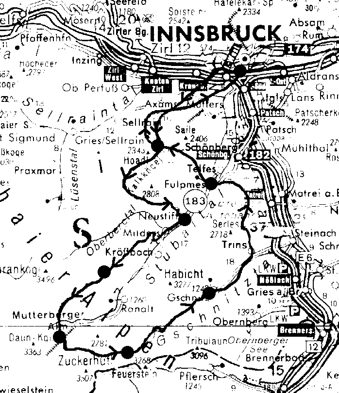
The route. The big blobs are over-night stay places. |
Contact: Ken Baldry, 17 Gerrard Road, Islington, London N1 8AY +44(0)20 7359 6294 or e-mail him URL: http://www.art-science.com/Ken/Alpine/Stubai/index.html
Last revised 1/6/2012 © 1998-2012 Ken Baldry. All rights reserved.