 |
Ken Baldry's Alpine PagesChamonix to Zermatt - Day Six - The Three Passes |
From the Mont Fort Hut to the Prafleuri Hut
|
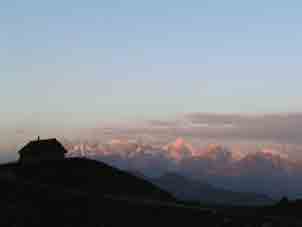
Saturday 3rd September 2005 The signpost outside the Mont Fort hut is criminal, in that the times are most misleading, as I wil show later. Although I had ordered breakfast for six, it did not turn up until 0630, for which the guardian apologised. It was adequate & the bill, including my SAC discount, was Sfr60 but as well, I had had to buy a lot of water last night, as it is not drinkable out of the tap here. I was still away at 0710, which meant that I had a cool & pleasant walk, then scramble, to the top of the Col de la Chaux at 2940m. This does require care, as the rocks set in the glacier, the edge of which one goes up, are usually set very firmly but some are covered in a film of ice. By starting early, I was out of the Sun all the time. The glacier itself looks stagnant, which means the ice is very hard.The signpost time was 1 hour 50 minutes & I got up in ten minutes less (age 62), probably because I scramble well, although I squashed a finger which bled all over the place. |
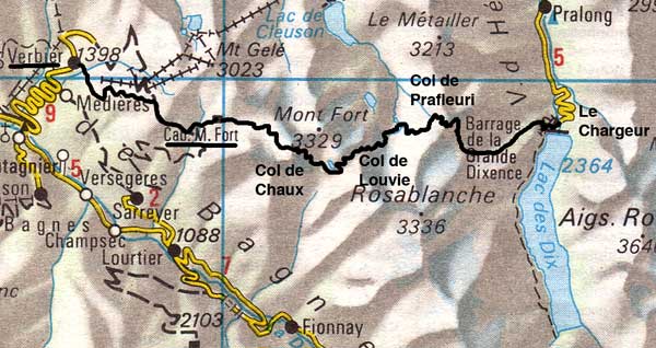
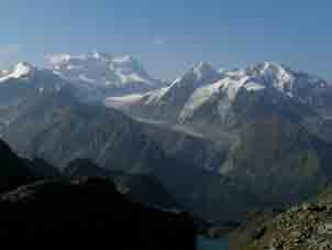
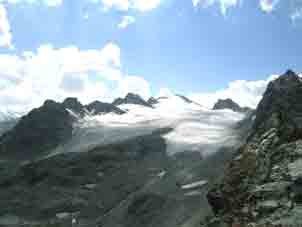
Mont Blanc group first thing. |
Reasonable West side of the |
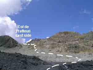
Horrible East side of the |
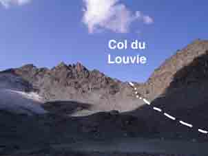
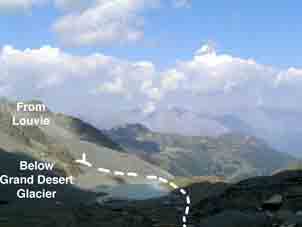
The other side is awful. Kev Reynolds says there are a lot of waymarks but you cannot see then going down & a steep, slippery & thoroughly disgusting path leads down from the top bit, which requires extreme care. I went on bits of secure-looking rock to its side where I could. Below this was a flatter rocky section, where I used my loaf as to which way to go & this was to the right of a mound over small snowfields, eventually meeting the waymarks coming from the left onto a moraine top path, a pleasant path past the lake which eventually meets the path coming from the Col de Termin, the alternative route from the hut, after 61 minutes. I saw several people here but none from the hut & in fact, those never caught up with me, all starting later. But the signpost had said 1 hour from the Col de la Chaux to the Col de Louvie, 2927m, which proved to be a further 35 minutes up. The first half of this is steep path but it eases near the top & there is a long waymarked track down to the lake at the bottom of the Grand Desert Glacier at about 2740m.
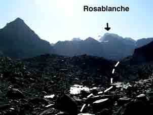
Rosablanche from the |
Grand Combin from the |
East side of the |
The path to the left mentioned by Kev Reynolds is no longer there & the lake is much bigger than he suggested because of the shrinking glacier. It took 39 minutes to get down. Trying to match the view with the map proved difficult, as one cannot see the Prafleuri Pass or where it actually is. I walked past the lake to a bridge & after crossing, it headed off South-East by guesswork until I saw that the track was over stepping stones in the lake, above which one could spot a waymark. I preferred my way when I saw others crossing the dodgy stones!
 |
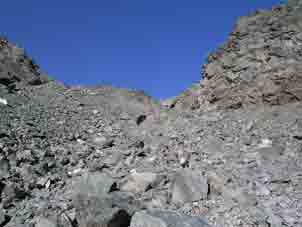
Fortunately, there are copious waymarks now, some large & one huge. I stopped for lunch (16 minutes) & worked my way up to a terrace of stones & little lakes at about 2800m, from which one could see a glacier above & forward. At the end of the terrace, there was a steep & exposed path which, although it drops safely to the bottom of the glacier, is no place for anyone of a nervous disposition, as other reports on the web have shown it to psych some people. It is further than it looks to amble below the glacier to the bottom of the Col de Prafleuri & it was now 1244. The first bit is obscure & steep to a waymark but a reasonable scramble. The path & marks improve somewhat to the highest top of the day of 2987m at 1323 but there is still some scrambling to do. The view is remarkable. |
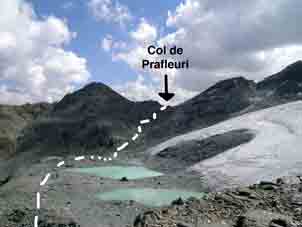
Col de Prafleuri from the plateau. |
Rosablanche from the |
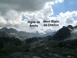
R = Col de Roux from the |
To the right is the Rosablanche hill with a glacier coming down to eventually fill the valley with numerous watercourses. In the distance are the Pigne de Arolla & Mont Blanc de Cheilon. (If you are following Kev Reynolds route, the Col de Roux can be spotted). There is a steep but safe path which heads off to the North & winds down to the wet area, where a long & very easy stroll takes one round to the top of the path (in Kev's 'grim valley' but like Dungeon Ghyll) to just below the Prafleuri Hut at 2624m by 1416. This was 6 hours 50 minutes deducting lunch & the sign at the Mont Fort Hut says two hours (!) less. What sort of fell-runner set those times?
Prafleuri Hut behind me |
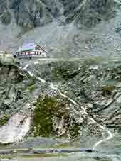
Prafleuri Hut & the 60m struggle up. |
You don't have to go up to the Prafleuri Hut. Along the East side of the valley, there is now a path to Le Chargeur with only one problematic rock-fall to cross & I was there by 1523. If I had been going on this year, I would have stayed at the hotel there. However, I did that last year, see the next page. |
Contact: Ken Baldry, 17 Gerrard Road, Islington, London N1 8AY +44(0)20 7359 6294 or e-mail him URL: http://www.art-science.com/Ken/Alpine/C-Z/cz6.html Last revised 23/6/2013 ©2004-2013 Ken Baldry. All rights reserved.